

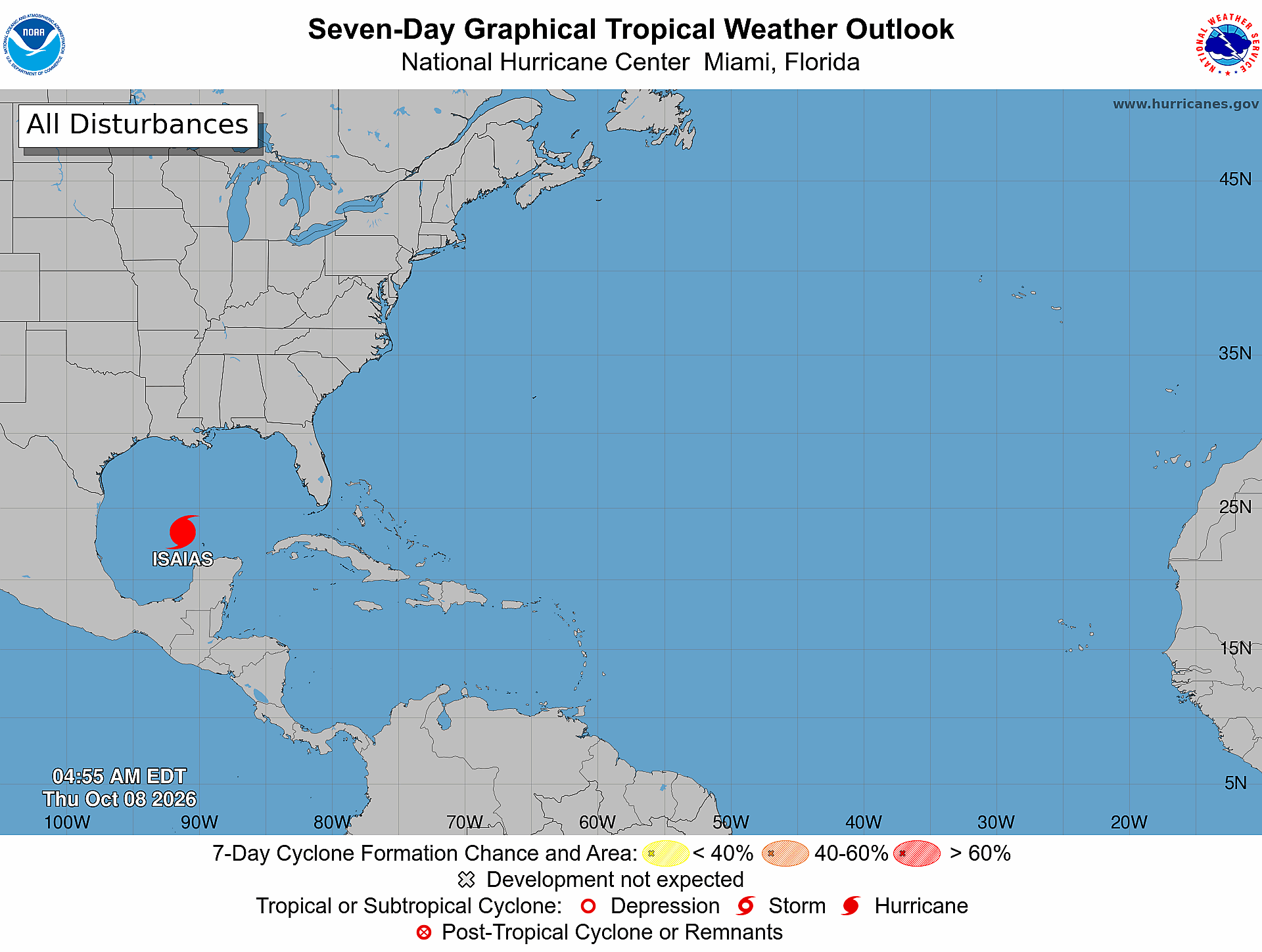
Florida hurricane-season check for October 8, 2026: The National Hurricane Center’s printed 2:00 AM EDT Atlantic outlook says it is issuing advisories on upgraded Hurricane Isaias over the southwestern Gulf of America and states, “Tropical cyclone formation is not expected during the next 7 days.” [1] Conditions can change quickly; use the linked NHC advisory for the latest storm-specific information.
Official Atlantic Outlook at a Glance
- Printed text outlook issue time: 2:00 AM EDT Thursday, October 8, 2026. [1]
- Product: ABNT20 KNHC 080510 / TWOAT. [1]
- Area covered: The North Atlantic, Caribbean Sea, and Gulf of America. [1]
- Active system: Upgraded Hurricane Isaias over the southwestern Gulf of America. [1]
- Additional formation areas: None listed. NHC states, “Tropical cyclone formation is not expected during the next 7 days.” [1]
- Formation percentages: None reported because the outlook lists no separate disturbance or formation area. Do not read that absence as an invented 0% value. [1]
- Forecaster: Roberts. [1]
What the Current Hurricane Advisory Says
NHC’s 4:00 AM CDT advisory places Hurricane Isaias near 23.3°N, 91.2°W, with maximum sustained winds of 80 mph and movement toward the east-northeast at 9 mph. [3] The advisory says Isaias is expected to make landfall within the northern Gulf Coast warning area late Friday or early Saturday; that forecast is not a Treasure Coast landfall statement. [3]
The advisory lists a storm-surge warning from the mouth of the Mississippi River to Steinhatchee River, Florida; a hurricane warning from Ocean Springs, Mississippi, to the Bay/Gulf County line, Florida; tropical-storm warnings from the Jefferson/Plaquemines Parish line, Louisiana, to west of Ocean Springs and from east of the Bay/Gulf County line to Aucilla River, Florida; and a storm-surge watch from Steinhatchee River to Yankeetown, Florida. [3] NHC says people in the warning areas should follow local officials’ instructions and monitor their local National Weather Service office for area-specific information. [3]
What the Seven-Day Graphic Shows
The official seven-day graphic is timestamped 4:55 AM EDT Thursday, October 8, 2026. It shows a hurricane symbol labeled ISAIAS in the southwestern Gulf and no shaded disturbance formation areas elsewhere in the Atlantic basin. [2] Its legend distinguishes an existing tropical cyclone from separate formation areas; the no-formation statement concerns additional tropical cyclone formation, not whether Isaias already exists. [1] [2]
What This Means for the Treasure Coast
The cited 4:00 AM CDT advisory does not list Port Saint Lucie, Jensen Beach, Fort Pierce, or Vero Beach inside its coastal watch or warning segments. [3] That is a bounded reading of this advisory—not an all-clear for future tropical or non-tropical weather. NHC says to monitor local National Weather Service products for information specific to your area. [3]
A Practical Hurricane-Season Tech Check
Practical guidance from The IT Guys: Charge power banks, confirm emergency alerts are enabled, save important contacts for offline access, and keep a separate backup of essential documents and business data. [4] [5] These are The IT Guys’ practical technology extensions of official prepare-ahead guidance, not verbatim NOAA or NWS checklist items, and they do not guarantee safety or business continuity. The National Weather Service recommends knowing your evacuation zone, assembling an emergency kit, checking emergency equipment, and writing or reviewing a family emergency plan. [4] NOAA also advises understanding hurricane risk, beginning preparations before danger arrives, keeping multiple ways to receive forecasts and alerts, and knowing what to do before, during, and after a storm. [5]
Sources: Official Outlook, Advisory, and Preparedness Links
- [1] NHC Atlantic Tropical Weather Outlook text product
- [2] NHC Seven-Day Graphical Tropical Weather Outlook
- [3] NHC Hurricane Isaias public advisory
- [4] National Weather Service hurricane planning guidance
- [5] NOAA hurricane preparation resources
Reporting cutoff recorded by The IT Guys: 7:08 AM EDT (11:08 UTC) on October 8, 2026. [recorded by The IT Guys] This report reflects the 2:00 AM EDT outlook, 4:00 AM CDT hurricane advisory, and 4:55 AM EDT graphic. [1] [3] [2] Conditions can change; use the linked official products for the newest information.