

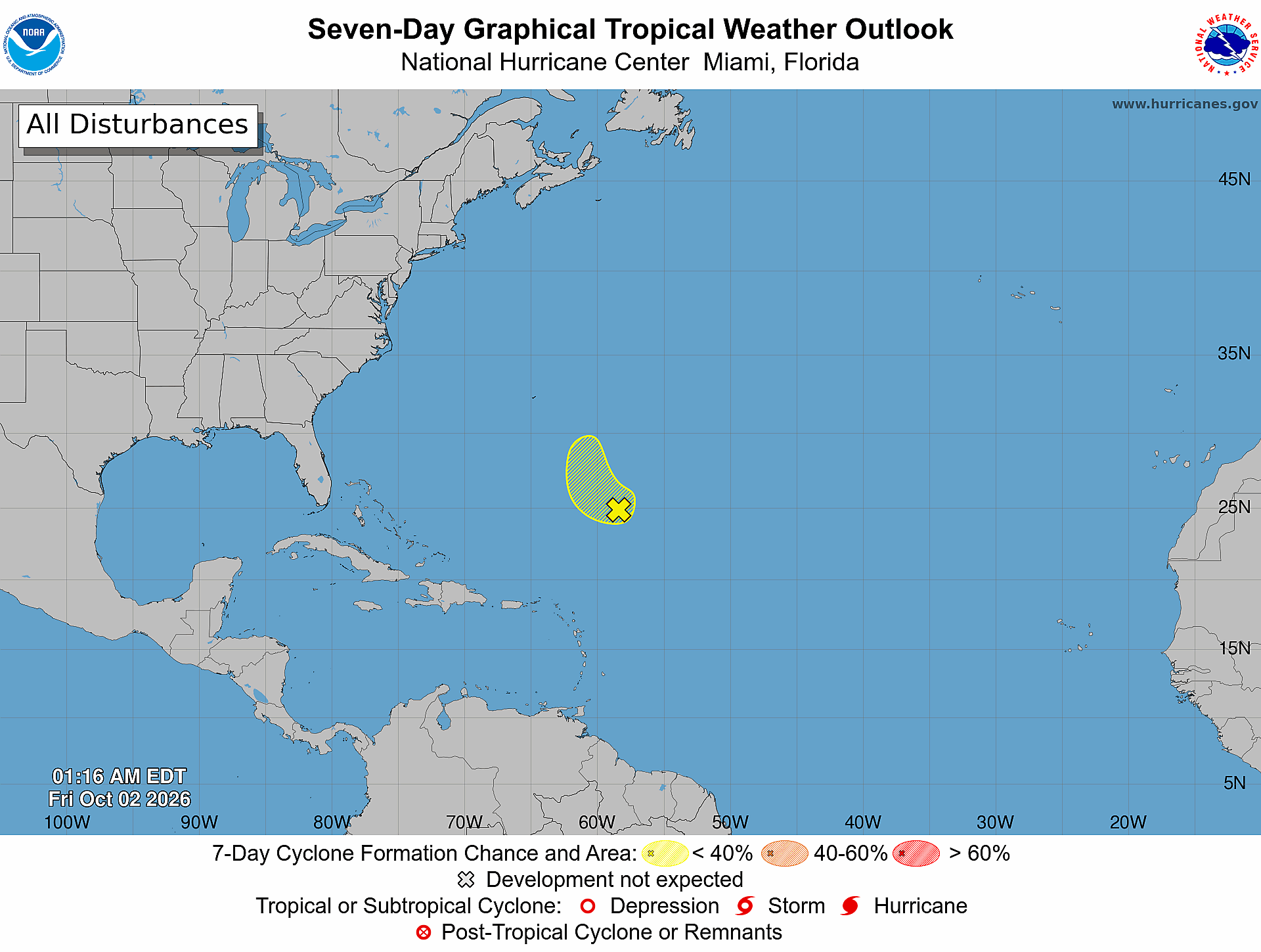
Florida hurricane-season check for October 2, 2026: In its 2:00 AM EDT Atlantic outlook, the National Hurricane Center is monitoring one area, the “Subtropical Central Atlantic (Remnants of Fay),” and gives it a low 10% formation chance through 48 hours and a low 10% chance through seven days. [1] NHC says the low is several hundred miles southeast of Bermuda and that dry air and strong upper-level winds are expected to prevent significant redevelopment while it moves northwestward, east of Bermuda. [1] Conditions can change; formation odds describe the chance of development, not a guaranteed track, landfall, or local impact.
Official Atlantic Outlook at a Glance
- Official text outlook time: 2:00 AM EDT Friday, October 2, 2026. [1]
- Product: ABNT20 KNHC 020516 / TWOAT. [1]
- Area covered: The North Atlantic, Caribbean Sea, and Gulf of America. [1]
- Monitored area: Subtropical Central Atlantic (Remnants of Fay). [1]
- Formation chance through 48 hours: low, 10 percent. [1]
- Formation chance through seven days: low, 10 percent. [1]
- Forecaster: Gibbs. [1]
What NHC Says About the Remnants of Fay
NHC reports ongoing thunderstorm activity near the low, but says dry air and strong upper-level winds should prevent significant redevelopment as it moves northwestward to the east of Bermuda. NHC adds that any formation chance should end by Sunday because of very strong upper-level winds. [1] Those statements are the agency’s point-in-time forecast, not a guarantee; use the live NHC products for updates.
What the Seven-Day Graphic Shows
The official Seven-Day Graphical Tropical Weather Outlook is timestamped 1:16 AM EDT Friday, October 2, 2026. [2] It shows one hatched yellow formation area with an “X” in the subtropical central Atlantic; its legend identifies yellow as a less-than-40% seven-day formation chance. [2] The exact 10% chances come from the text product, not from estimating the map shading. [1]
What This Means for the Treasure Coast
For Port Saint Lucie, Jensen Beach, Fort Pierce, and Vero Beach, this outlook does not identify a Treasure Coast tropical cyclone track, watch, warning, or local impact. [1] That is a bounded reading of this specific outlook—not an all-clear for future tropical or non-tropical weather. Recheck NHC products, local National Weather Service information, and county emergency-management notices as conditions evolve.
A Practical Hurricane-Season Tech Check
Practical guidance from The IT Guys: Use a low-probability outlook day to charge power banks, confirm emergency alerts are enabled, save important contacts for offline access, and keep a separate backup of essential documents and business data. The National Weather Service recommends knowing your evacuation zone, assembling an emergency kit, checking emergency equipment, and writing or reviewing a family emergency plan. [3] These tech steps are practical extensions of prepare-ahead guidance; they do not guarantee safety or business continuity.
Sources: Official Outlook and Preparedness Links
- [1] NHC Atlantic Tropical Weather Outlook text product
- [2] NHC Seven-Day Graphical Tropical Weather Outlook
- [3] National Weather Service hurricane planning guidance
- [4] NOAA hurricane preparation resources
Reporting cutoff recorded by The IT Guys: 7:03 AM EDT (11:03 UTC) on October 2, 2026. [recorded by The IT Guys] This report reflects the 2:00 AM text outlook and the 1:16 AM graphic. [1] [2] Conditions can change; use the linked official products for the newest information.