

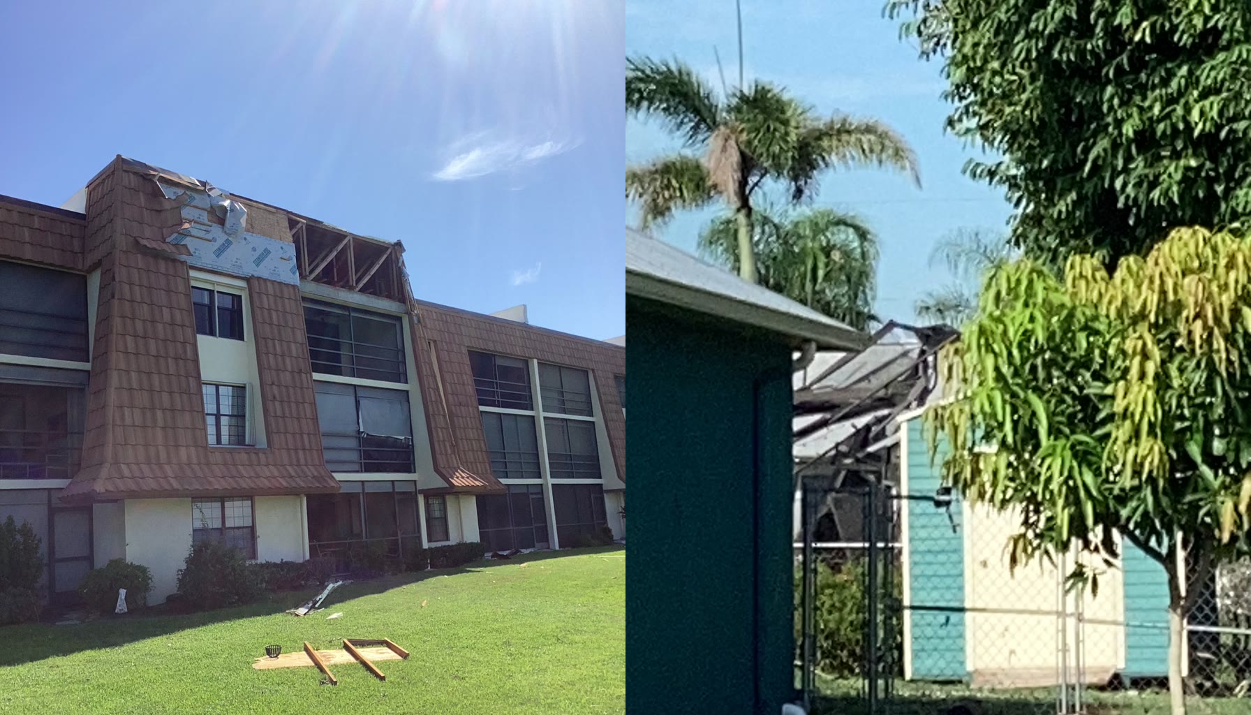
The tornado warning has ended. This is an aftermath and preparedness update, not an active-alert notice. At the reporting cutoff, the National Weather Service active-alert API listed no active tornado warning for St. Lucie County. Weather can change quickly, so residents should still check the linked official alert sources for current conditions.
The National Weather Service confirmed that a weak EF-0 tornado touched down in Port St. Lucie on Sunday evening, August 23, 2026. The NWS Melbourne overview says a strong thunderstorm interacting with the sea breeze produced the tornado. Local reporting from the NWS damage-survey briefing places the path at about 2.1 miles, with estimated winds of 65 to 75 mph, damage to roughly 20 to 30 homes, and no reported injuries.
Quick Read
- Event: EF-0 tornado in Port St. Lucie on August 23, 2026.
- Timing: Approximately 6:10 to 6:25 p.m. EDT.
- Path: About 2.1 miles, including a period over the St. Lucie River as a waterspout.
- Estimated peak winds: Up to 75 mph.
- Reported impact: About 20 to 30 homes damaged; roofs, trees, fences, boats, and pool enclosures were among the affected property.
- Injuries: None reported in the survey briefing.
- Current status at cutoff: The August 23 tornado warning is over; the NWS active-alert API listed no active tornado warning for St. Lucie County when checked.
What the Survey Found
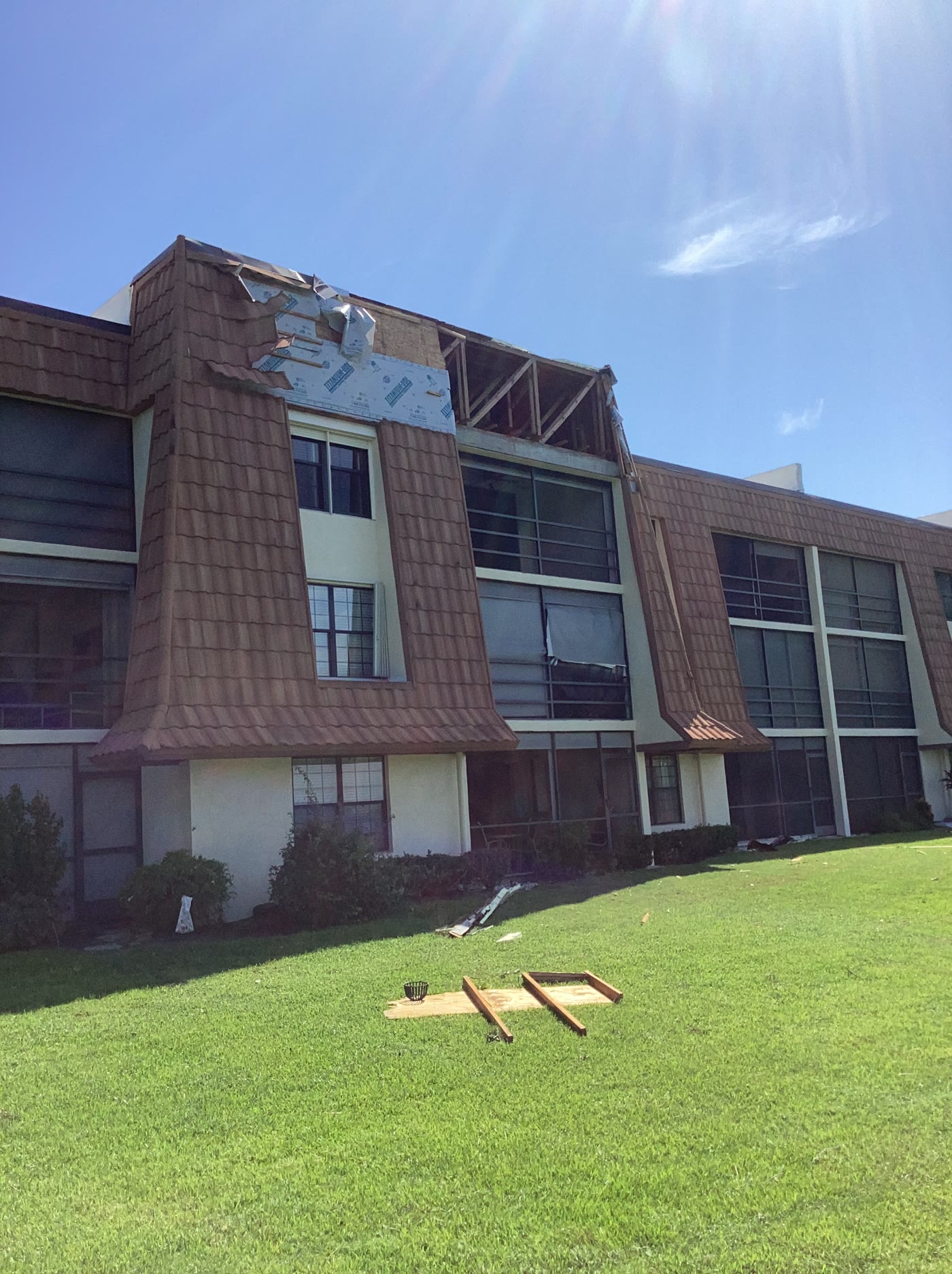
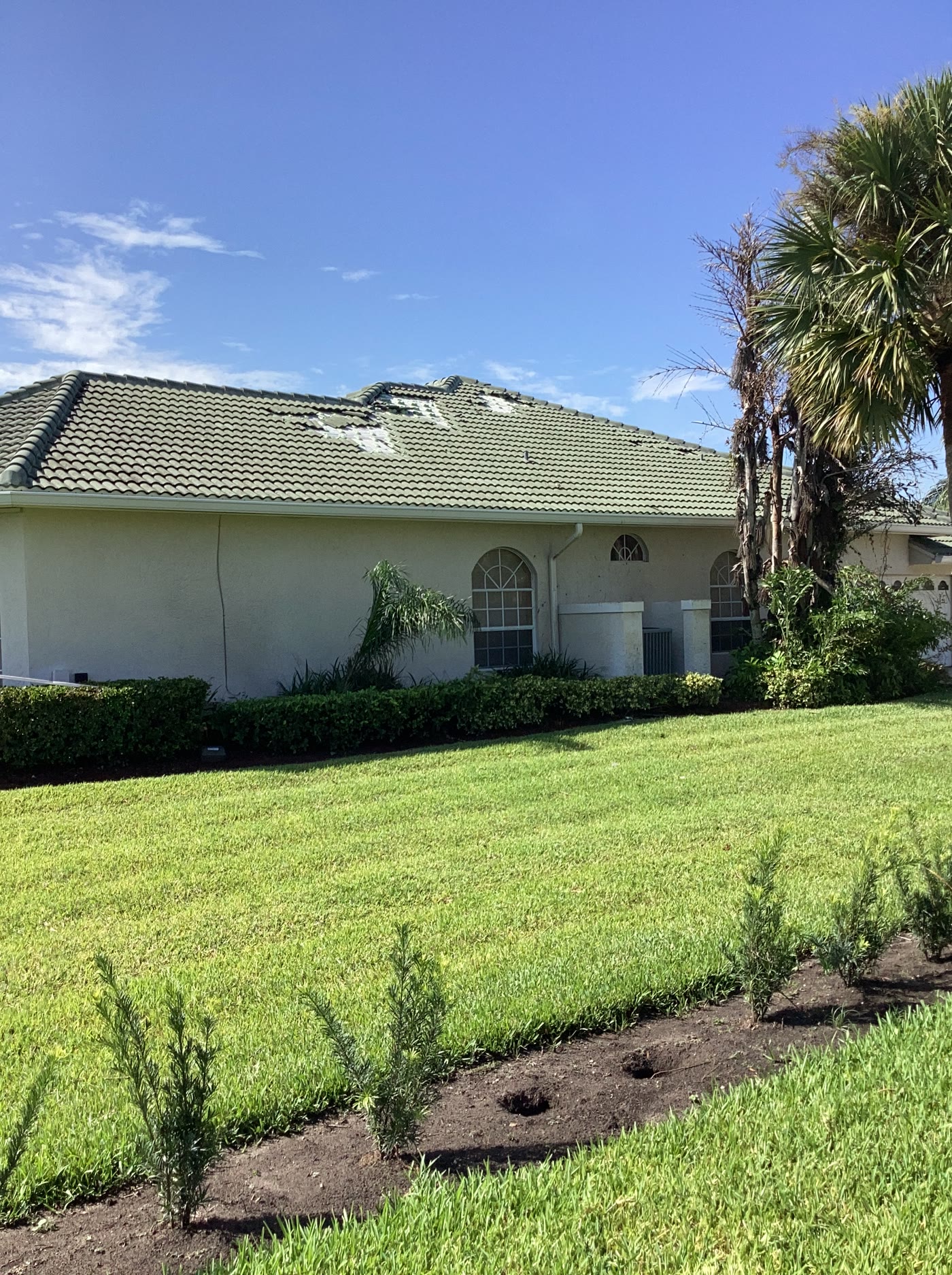
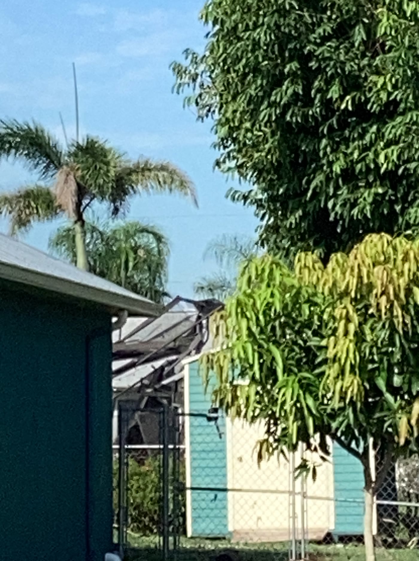
The tornado first touched down near Southeast Kitching Cove Lane and Southeast Morningside Boulevard at about 6:10 p.m., according to the NWS briefing reported by WFLX. It caused roof, soffit, and pool-enclosure damage before moving over the St. Lucie River, where it became a waterspout for several minutes. It then moved back onshore near the Bay St. Lucie community around 6:20 p.m. and continued toward the Southbend area before dissipating.
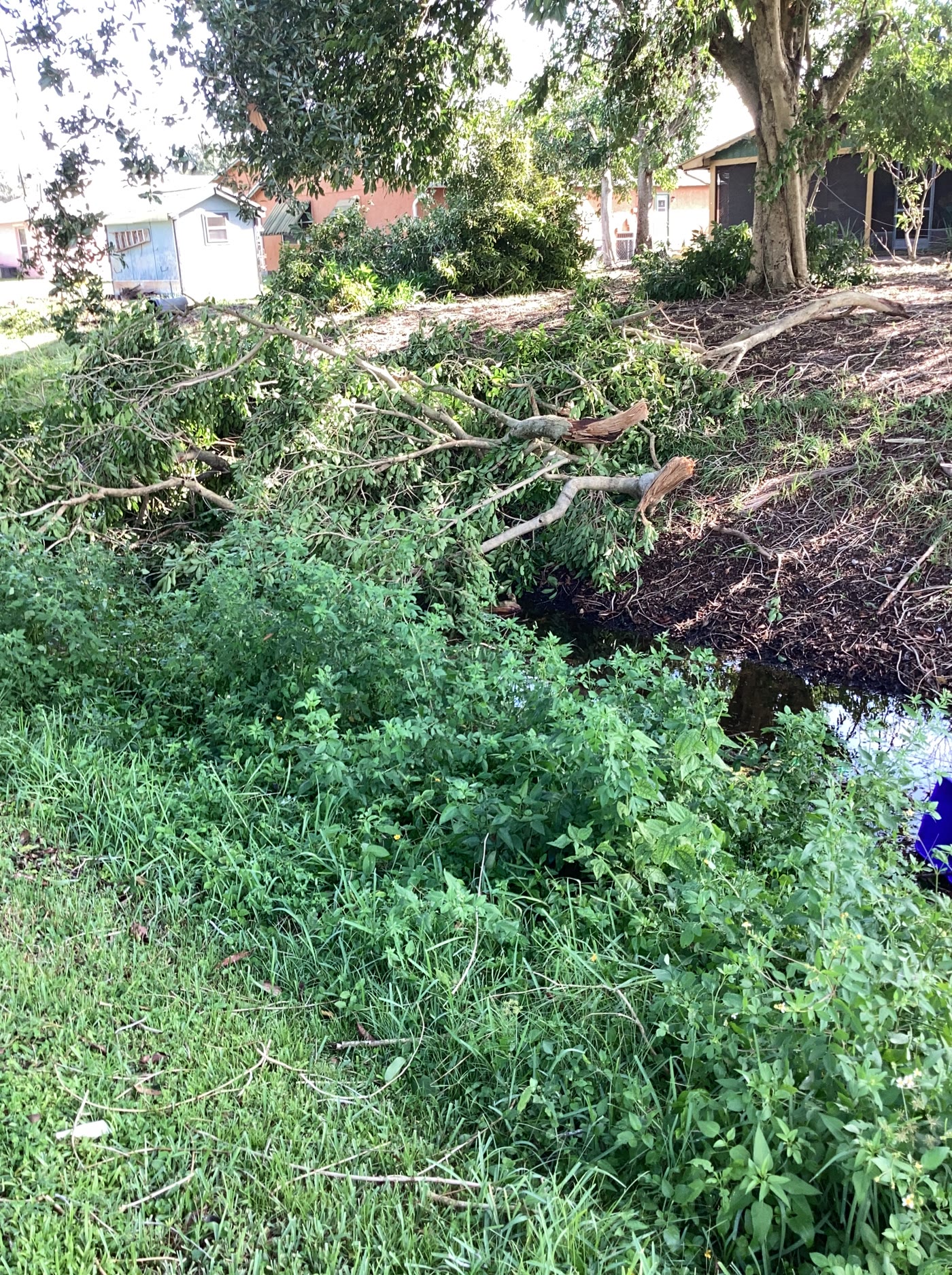
NWS survey data recorded damage to homes, low-rise residential buildings, hardwood trees, and other property. The selected official survey photographs below show the range of impacts without relying on copyrighted television-news images.
Why the Warning Arrived After the First Touchdown
The timing raised understandable questions. The tornado warning was issued at 6:28 p.m., after the tornado had first touched down and after some residents said the circulation had already passed their homes. WPTV reported that the warning area included about 145,000 people.
The NWS said it found no known technical or dissemination failure in its own systems. Instead, this was a small, shallow circulation that radar did not sample well. The Melbourne radar’s lowest beam was around 5,000 feet above the ground in this area, and NWS described the detected rotation as weak and broad, with average rotational velocity around 20 knots or less.
That distinction matters. A landspout can develop from rotation close to the ground beneath a growing thunderstorm, rather than from the deeper, stronger rotation meteorologists may be able to track higher in a storm. That can leave very little lead time. It does not make late alerts less frustrating; it explains why relying on one alert path is risky.
What Port St. Lucie Residents Can Do Now
- Document damage before cleanup. Photograph each affected area from wide and close angles, save copies somewhere other than the damaged phone or computer, and keep repair estimates and receipts together.
- Avoid damaged electrical equipment. If a desktop, television, router, UPS, or power strip was exposed to water or visible impact, leave it unplugged until it can be checked safely.
- Use more than one warning channel. Keep Wireless Emergency Alerts enabled, add a battery-powered NOAA Weather Radio, and review local notification options through the City of Port St. Lucie Emergency Management page.
- Check the settings on every household phone. Alert behavior can vary by device settings, cellular provider, and local notification service.
- Back up the records that matter. Insurance documents, inventories, family photos, account-recovery information, and small-business continuity files should not exist on only one device.
- Recheck official conditions. The warning from this event is over, but Florida weather changes quickly. Use NWS Melbourne and the NWS active-alert feed for current information.
About the Damage Photos
The images in this report come directly from the NOAA/National Weather Service Damage Assessment Toolkit. The NWS reuse policy says information on its web pages is in the public domain unless specifically noted otherwise, while requiring users not to claim the material as their own, imply government endorsement, or present modified content as official government material.
The IT Guys applied camera orientation, removed embedded metadata, and resized the photographs for web delivery. The featured image is an editorial side-by-side layout made from two of the credited survey photographs. No people, readable addresses, street signs, license plates, or personal documents are visible in the selected images.
Sources
- National Weather Service Melbourne: EF-0 Tornado in Port St. Lucie, August 23, 2026
- WFLX: National Weather Service confirms EF-0 tornado touchdown in Port St. Lucie
- WPTV: Port St. Lucie residents say tornado alerts came too late
- CBS12: Why some residents did not receive a warning until after the tornado
- NOAA/NWS Damage Assessment Toolkit
- NWS disclaimer and reuse terms
Reporting cutoff: 7:20 am. EDT on August 25, 2026.