

Florida hurricane-season check for October 10, 2026: The National Hurricane Center’s Atlantic outlook is printed as 2:00 AM EDT and says it is issuing advisories on Hurricane Isaias, located inland over southern Alabama. It states, “Tropical cyclone formation is not expected during the next 7 days.” [1] The latest storm-specific advisory classifies Isaias as post-tropical, so readers should use that newer advisory for current hazards and status. [3] Conditions can change; always reopen the official products for the newest information.
Official Atlantic Outlook at a Glance
- Printed text outlook issue time: 2:00 AM EDT Saturday, October 10, 2026. [1]
- Product: ABNT20 KNHC 100512 / TWOAT. [1]
- Area covered: The North Atlantic, Caribbean Sea, and Gulf of America. [1]
- Active-system entry: Hurricane Isaias, described in this outlook as inland over southern Alabama. [1]
- Additional formation areas: None listed. NHC states, “Tropical cyclone formation is not expected during the next 7 days.” [1]
- Formation percentages: None reported because no separate disturbance or formation area is listed. That absence is not an official 0% value. [1]
- Forecaster: Gibbs. [1]
What the Latest Isaias Advisory Says
NHC’s 4:00 AM CDT advisory calls Isaias a post-tropical cyclone centered near 32.0°N, 86.5°W, about 25 miles south-southwest of Montgomery, Alabama, with maximum sustained winds of 35 mph and northward movement at 14 mph. [3] NHC forecast it to move across Alabama and into the Tennessee Valley later Saturday and Sunday, weaken, and dissipate Sunday. [3]
The advisory says all storm-surge and tropical-storm warnings were discontinued and no watches or warnings were in effect. [3] It also says this was NHC’s last public advisory on Isaias and directs future system information to Weather Prediction Center public advisories beginning at 10:00 AM CDT. [3]
Hazards still matter after the label changes: NHC forecast 4 to 8 inches of rainfall across southern Alabama, the Florida Panhandle and Big Bend, and southwest Georgia through the weekend, with localized totals up to 15 inches possible—particularly in bands across the Florida Panhandle and Big Bend. It also described possible flash, urban, and river flooding; a tornado risk across parts of the eastern Florida Panhandle, Georgia, and the Carolinas; and life-threatening surf and rip-current conditions along affected Gulf coasts. [3]
What the Seven-Day Graphic Shows
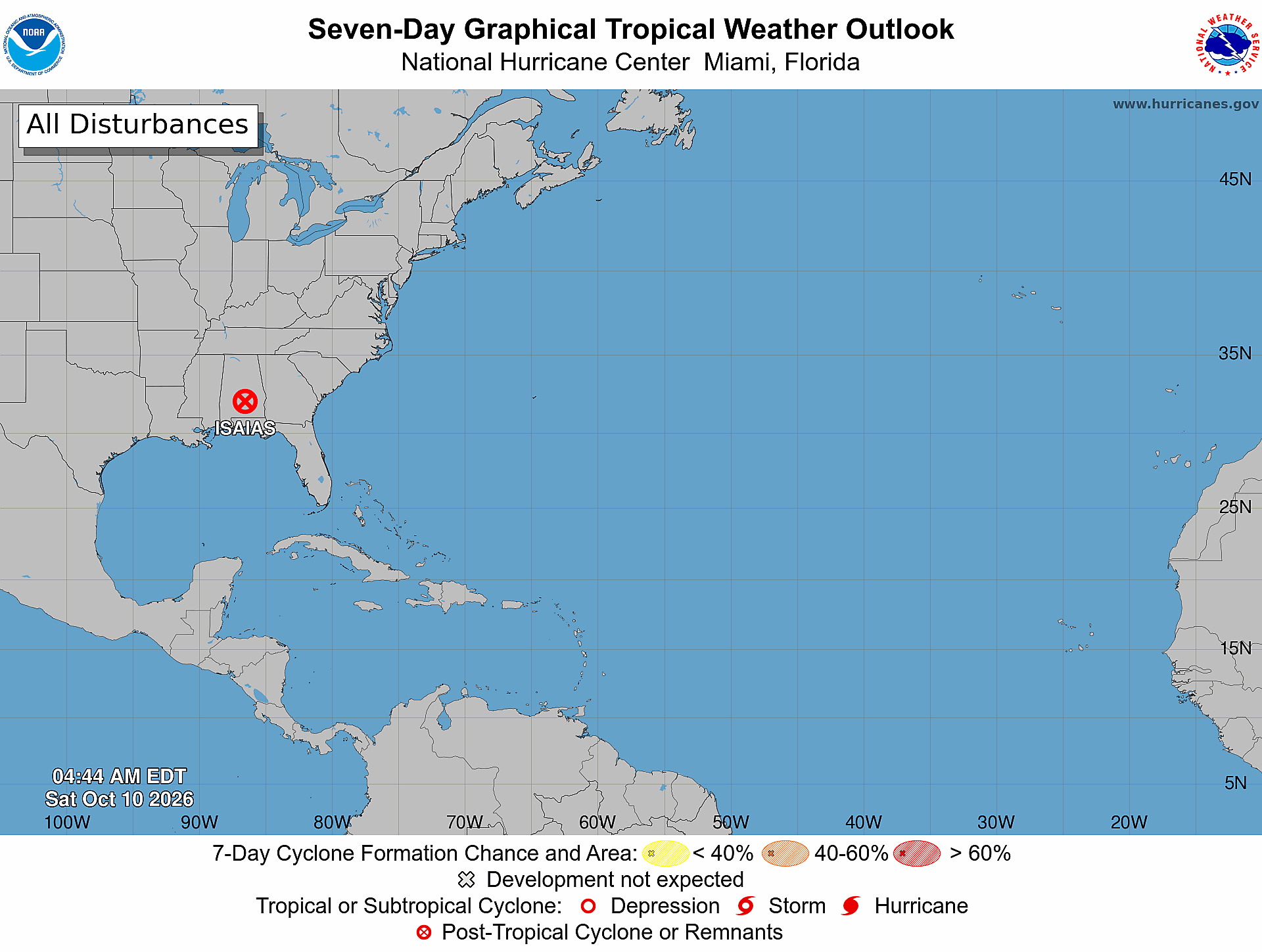
The official seven-day graphic is timestamped 4:44 AM EDT Saturday, October 10, 2026. It shows a post-tropical-cyclone/remnants symbol labeled ISAIAS over Alabama and no shaded formation areas elsewhere in the Atlantic basin. [2] The complete map title, timestamp, label, and legend are visible in the retained NOAA/NHC image.
What This Means for the Treasure Coast
The cited advisory’s rainfall and tornado hazard areas do not name Port Saint Lucie, Jensen Beach, Fort Pierce, or Vero Beach. [3] That is a bounded reading of this specific advisory—not a guarantee about later tropical or ordinary weather. Treasure Coast residents and businesses should continue checking local National Weather Service alerts and current NHC products.
A Practical Hurricane-Season Tech Check
Practical guidance from The IT Guys: Charge power banks, confirm emergency alerts are enabled, keep important contacts available offline, and maintain a separate backup of essential documents and business data. [4] [5] These are practical technology extensions of official prepare-ahead guidance, not verbatim NOAA or NWS checklist items, and they do not guarantee safety or business continuity. The National Weather Service recommends knowing your evacuation zone, assembling an emergency kit, checking emergency equipment, and writing or reviewing a family emergency plan. [4] NOAA advises understanding hurricane risk, preparing before danger arrives, keeping multiple ways to receive forecasts and alerts, and knowing what to do before, during, and after a storm. [5]
Sources: Official Outlook, Advisory, and Preparedness Links
- [1] NHC Atlantic Tropical Weather Outlook text product
- [2] NHC Seven-Day Graphical Tropical Weather Outlook
- [3] NHC Post-Tropical Cyclone Isaias public advisory
- [4] National Weather Service hurricane planning guidance
- [5] NOAA hurricane preparation resources
Reporting cutoff recorded by The IT Guys: 7:04 AM EDT (11:04 UTC) on October 10, 2026. [recorded by The IT Guys] This report reflects the 2:00 AM EDT outlook, 4:00 AM CDT Isaias advisory, and 4:44 AM EDT graphic. [1] [3] [2] Conditions can change; use the linked official products for the newest information.