

Florida hurricane-season check for September 6, 2026: In its 2:00 AM EDT Atlantic outlook, the National Hurricane Center stated: “Tropical cyclone formation is not expected during the next 7 days.” [1] NHC lists no active system, disturbance, or monitored formation area in this product, so it reports no per-area 2-day or 7-day formation percentages. [1] That is not an invented 0% forecast or an all-clear for every weather hazard. Conditions can change; recheck official forecasts and local alerts.
Quick Read
- Official text issue time: 2:00 AM EDT Sunday, September 6, 2026. [1]
- Product: ABNT20 KNHC 060511 / TWOAT. [1]
- Area covered: The North Atlantic, Caribbean Sea, and Gulf of America. [1]
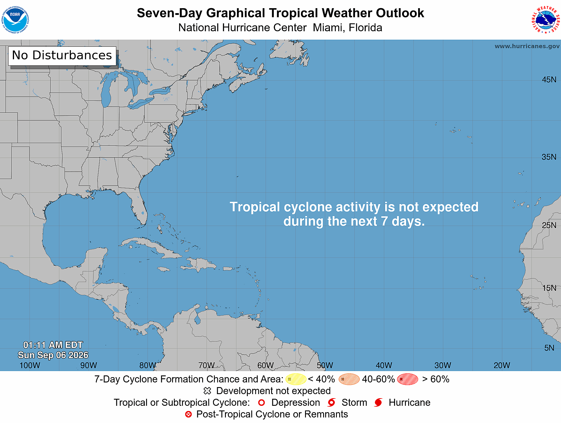
- Systems and monitored areas: None are listed in the current text product; the graphic is labeled “No Disturbances.” [1] [2]
- Formation outlook: “Tropical cyclone formation is not expected during the next 7 days.” [1]
- Formation percentages: No per-area 2-day or 7-day percentages are reported because no disturbance or formation area is listed. The absence of percentage lines should not be rewritten as 0%. [1]
- Current graphic: The official seven-day map is valid at 1:11 AM EDT Sunday, September 6, 2026. It says “No Disturbances” and “Tropical cyclone activity is not expected during the next 7 days.” [2]
What NOAA/NHC Is Reporting
The official Atlantic text product covers the North Atlantic, Caribbean Sea, and Gulf of America. Its complete formation statement is: “Tropical cyclone formation is not expected during the next 7 days.” [1] Forecasters Katz and Beven signed the product. [1] The separate graphical outlook, timestamped 1:11 AM EDT, uses the wording “Tropical cyclone activity is not expected during the next 7 days.” [2]
What This Means for the Treasure Coast
For Port Saint Lucie, Jensen Beach, Fort Pierce, and Vero Beach, today’s outlook supports routine hurricane-season readiness rather than a storm-specific local track or impact claim. The outlook does not identify a Treasure Coast threat, but conditions and forecasts can change. [1] NOAA advises having multiple ways to receive forecasts and alerts and knowing what to do before, during, and after a storm. [4] Before a storm threatens, the National Weather Service advises checking whether you are in an evacuation area through local government or emergency management and making an emergency plan. [3]
Practical Hurricane-Season Tech Check
Practical guidance from The IT Guys: Use quiet outlook days to charge power banks, confirm emergency alerts are enabled, save critical contacts for offline access, and make a separate backup of important documents and business data. [4] Test how you would communicate and keep essential devices running during a power or internet outage. These are The IT Guys’ practical extensions of NOAA’s broad prepare-ahead and multiple-alert-path guidance—not a verbatim federal checklist—and they do not guarantee safety or business continuity.
Official Sources and Preparedness Links
- NHC Atlantic Tropical Weather Outlook text product
- NHC Seven-Day Graphical Tropical Weather Outlook
- National Weather Service: What to do before a tropical storm or hurricane
- NOAA: Hurricane preparation resources
Reporting cutoff: 7:12 AM EDT (11:12 UTC) on September 6, 2026. This report reflects the NOAA/NHC Atlantic Tropical Weather Outlook issued at 2:00 AM EDT [1] and the official seven-day graphic valid at 1:11 AM EDT [2]. Conditions can change; recheck the linked official products for the newest information.