

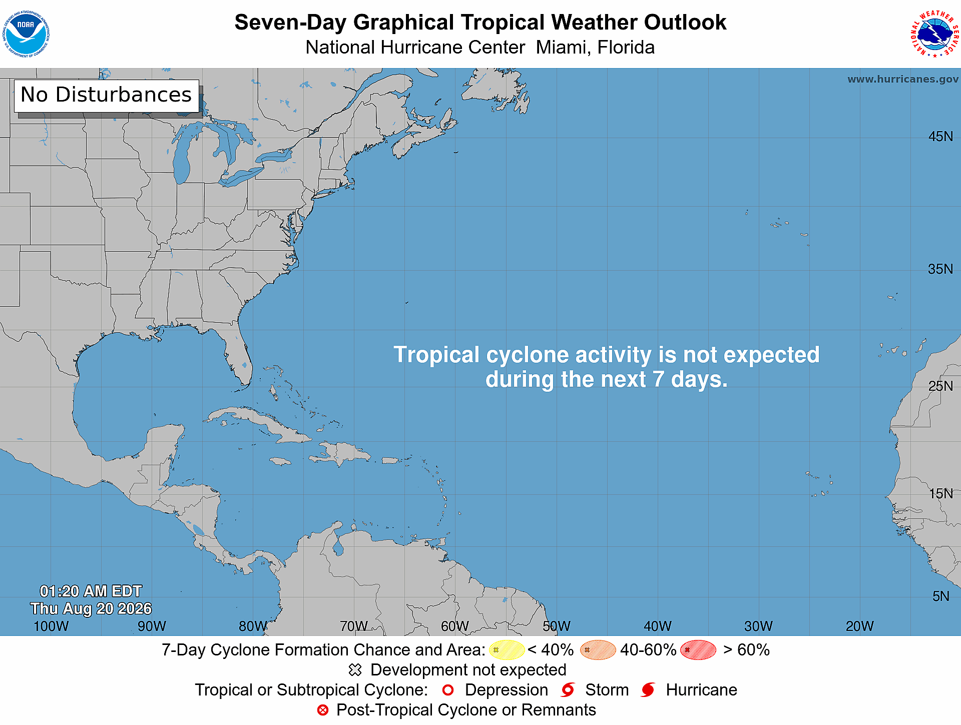
Daily Florida hurricane-season check for August 20, 2026: The National Hurricane Center says, “Tropical cyclone formation is not expected during the next 7 days.” The current Atlantic outlook lists no disturbances or active tropical cyclones. Conditions can change, so Treasure Coast residents and businesses should continue checking official updates throughout hurricane season.
Quick Read
- Official text issue time: 2:00 AM EDT Thursday, August 20, 2026.
- Product: ABNT20 KNHC 200520 / TWOAT.
- Area covered: The North Atlantic, Caribbean Sea, and Gulf of America.
- NHC’s exact formation statement: “Tropical cyclone formation is not expected during the next 7 days.”
- Systems or areas being monitored: None listed in this outlook.
- Formation chances: NHC lists no per-area percentages because no disturbance or formation area is identified; this article does not convert that absence into an invented 0% forecast.
- Florida/Treasure Coast: This is a quiet outlook, not a guarantee that conditions will remain quiet for the full week.
What Today’s Atlantic Outlook Says
The official text product contains no named disturbance, monitored formation area, or active tropical cyclone. The current seven-day graphic separately carries the label “No Disturbances” and states, “Tropical cyclone activity is not expected during the next 7 days.”
Because NHC does not identify a formation area, there are no 48-hour or seven-day percentages to report today. Formation chances describe development—not destination—and conditions may change as later outlooks are issued.
What This Means for the Treasure Coast
For Port Saint Lucie, Jensen Beach, Fort Pierce, and Vero Beach, today’s outlook provides a useful window for routine preparation without the pressure of an immediate tropical-development signal. It does not eliminate other weather hazards, predict the entire week with certainty, or replace local emergency-management guidance.
Use official NHC information for tropical development and follow local emergency-management instructions if watches, warnings, or evacuation orders are issued.
Practical Hurricane-Season Tech Check
- Charge power banks and test the cables used by every household phone.
- Confirm important documents and irreplaceable photos have a backup that is not stored only on one computer.
- Save account-recovery details and critical contacts somewhere available during an internet outage.
- Enable emergency alerts on each phone and test a battery-powered weather radio.
- Review family, pet, medication, and evacuation plans before the Atlantic becomes more active.
- Small businesses should test cloud backups, UPS batteries, remote-access procedures, and a simple staff communication plan.
Official Sources and Preparedness Links
- NHC Atlantic Tropical Weather Outlook text product
- NHC Seven-Day Graphical Tropical Weather Outlook
- NHC hurricane preparedness guidance
- Florida Division of Emergency Management: Plan and Prepare
Reporting cutoff: 7:03 AM EDT (11:03 UTC) on August 20, 2026. This report reflects the NOAA/NHC Atlantic Tropical Weather Outlook issued at 2:00 AM EDT and the official seven-day graphic valid at 1:20 AM EDT. Conditions can change; recheck the linked NHC products for the newest information.