

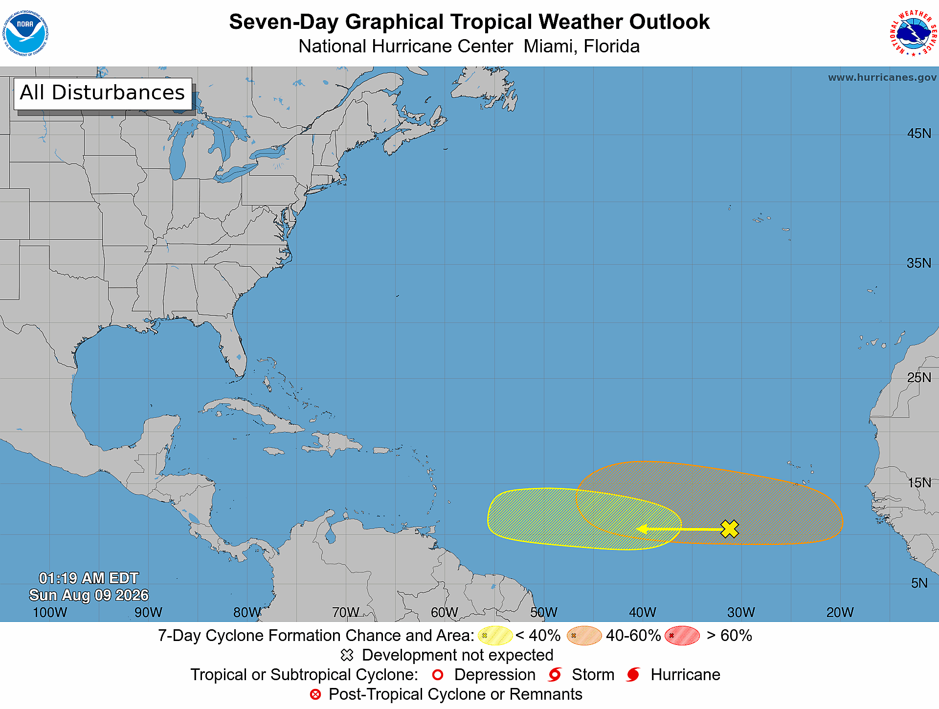
Daily Florida hurricane-season check for August 9, 2026: The National Hurricane Center is monitoring two tropical-wave areas in the tropical Atlantic. Both have a near 0 percent formation chance through 48 hours; their seven-day chances are 20 percent and 40 percent. Neither outlook describes a Florida impact or a forecast track. Conditions can change, so Treasure Coast residents and businesses should keep checking official updates.
Quick Read
- Official issue time: 2:00 AM EDT Sunday, August 9, 2026.
- Product: ABNT20 KNHC 090519 / TWOAT.
- Area covered: The North Atlantic, Caribbean Sea, and Gulf of America.
- Systems or areas being monitored: Two tropical-wave areas—the Central Tropical Atlantic, and the Eastern and Central Tropical Atlantic.
- Central Tropical Atlantic: Formation chance through 48 hours: low—near 0 percent. Formation chance through 7 days: low—20 percent.
- Eastern and Central Tropical Atlantic: Formation chance through 48 hours: low—near 0 percent. Formation chance through 7 days: medium—40 percent.
- Forecaster: Papin.
What the National Hurricane Center Is Watching
1. Central Tropical Atlantic
NOAA reports a broad area of showers and thunderstorms associated with a tropical wave several hundred miles southwest of the Cabo Verde Islands. Some gradual development is possible during the early to middle part of this week as the disturbance moves westward across the central tropical Atlantic. Upper-level winds are expected to become less conducive for development later in the week as the system approaches the Lesser Antilles.
- Through 48 hours: low—near 0 percent
- Through 7 days: low—20 percent
2. Eastern and Central Tropical Atlantic
Another tropical wave is expected to move off the west coast of Africa early this week. NOAA says environmental conditions are forecast to be conducive for gradual development afterward, and a tropical depression could form during the latter half of this week while the system moves westward across the eastern and central tropical Atlantic.
- Through 48 hours: low—near 0 percent
- Through 7 days: medium—40 percent
What This Means for Florida and the Treasure Coast
This outlook does not identify a current Florida threat, landfall forecast, warning, or watch. The monitored areas are far out in the tropical Atlantic, and NOAA’s formation percentages describe the chance that a tropical cyclone will form within each area—not the chance that a storm will reach Florida.
For Port Saint Lucie, Jensen Beach, Fort Pierce, and Vero Beach, today’s practical takeaway is to stay aware rather than alarmed. Tropical waves can strengthen, weaken, or fail to organize, and any future track forecast would come only after sufficient development and analysis. Check the latest official outlook instead of relying on old screenshots or social-media track speculation.
Five Practical Tech-Readiness Steps
- Test your backups: Confirm important documents, photos, accounting records, and device-recovery information exist in at least two places, including one copy away from your home or office.
- Prepare for power and internet interruptions: Charge power banks, verify UPS battery health, and know which essential modem, router, phone, or computer equipment you will power first.
- Protect account access: Store recovery codes securely, update emergency contacts, and make sure a trusted decision-maker can reach essential business accounts without sharing passwords.
- Save official information: Bookmark the NHC outlook and your local National Weather Service resources. A saved forecast screenshot can become outdated quickly.
- Plan safe shutdowns: Know how to shut down and unplug sensitive electronics before unsafe conditions arrive. Never risk personal safety to protect equipment.
Official Sources and Preparedness Links
- NOAA/NHC Atlantic Tropical Weather Outlook text product
- NOAA/NHC Seven-Day Atlantic Graphical Tropical Weather Outlook
- National Weather Service: Make a Hurricane Plan
- Ready.gov: Hurricanes
Outlooks are snapshots and can change with each NOAA/NHC issuance. This article summarizes the 2:00 AM EDT outlook issued August 9, 2026, and is not a substitute for emergency instructions from official authorities.